QCdesigns

Site analysis · Eastside, Riverside, California

2731–2871 University Avenue

Seven parcels and 1.9 acres on the avenue that joins Downtown Riverside to the university.

The verdict Draft

A strong site for mixed-use infill, if it is designed around the street edge and its neighbors.

Final wording to be agreed by the group on Wednesday.
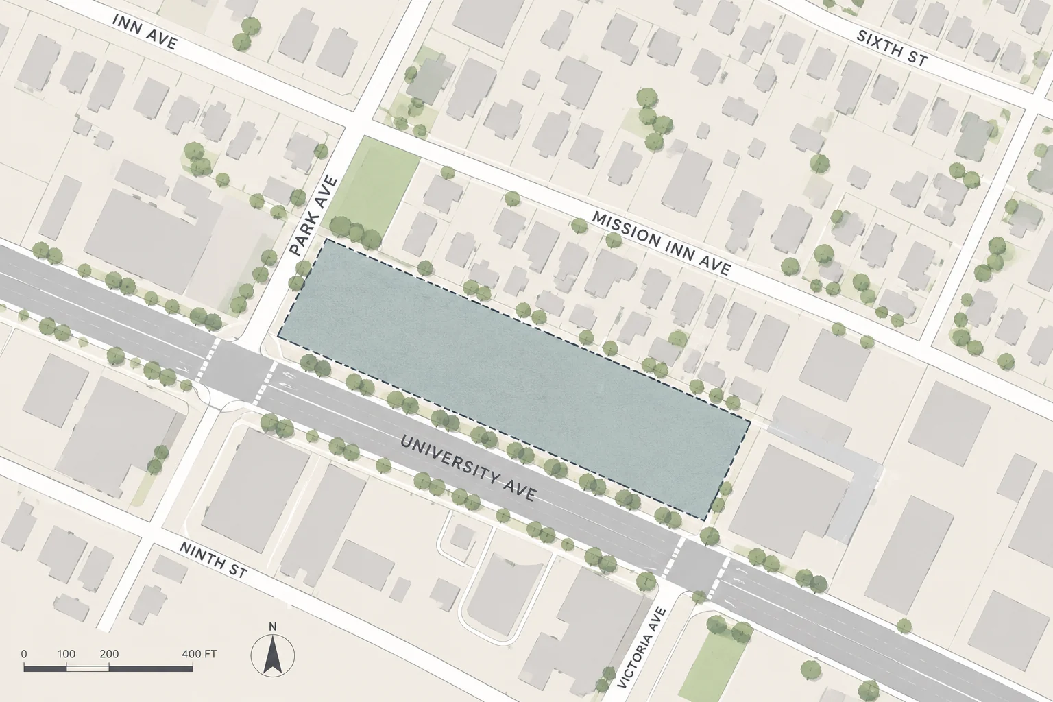
Site plan of 2731 to 2871 University Avenue: seven tinted parcels fronting University Avenue between Park Avenue and Victoria Avenue, with Mission Inn Avenue to the north
Fig. 01Site plan. The seven parcels (tinted) front University Avenue between Park Avenue and Victoria Avenue. Base: City of Riverside parcel data; drawn by QuiteCHIC Designs.
Area1.9acres
Parcels7contiguous
Sun over the site now—See today’s sun path ↓

01Context

A corridor between two anchors.

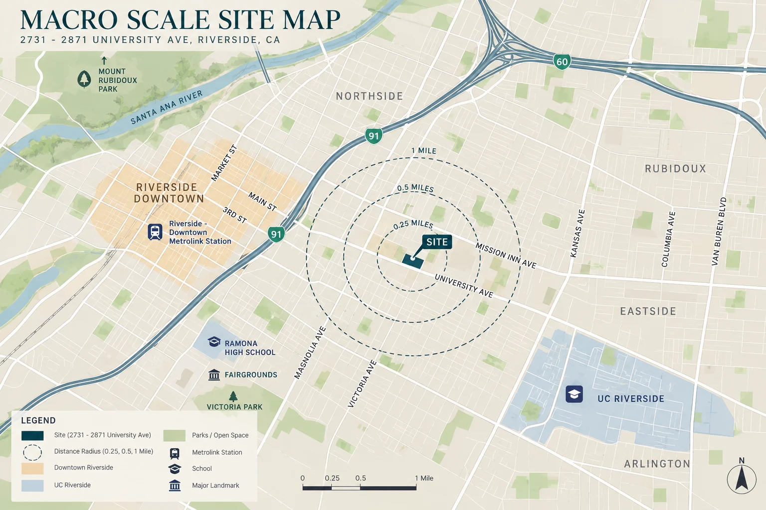
University Avenue is the street that ties Downtown Riverside to the campus. The site sits about a mile from one and a mile and a half from the other.

Seven contiguous parcels form a long rectangle with its full south frontage on University Avenue, a major commercial corridor near the city’s historic districts. Park Avenue closes the west end, Mission Inn Avenue and single-family houses sit to the north, and Victoria Avenue bounds the east.

The block belongs to the Eastside, one of Riverside’s oldest neighborhoods, with a history of racial and economic segregation and a clear set of present-day priorities: cultural preservation, economic opportunity and development that does not displace the people who live here.
Address2731–2871 University Avenue, Riverside, CA 92507
NeighborhoodEastside, between Downtown and UC Riverside
ZoningMixed use: housing over active ground-floor retail; 10–15 ft setbacks used for patio seating
OwnershipCity-held surplus land since 2020–22; redevelopment agreements approved 2026 Verify
TransitRTA Route 1 stops on University Avenue; Metrolink and Amtrak at Downtown Riverside
Macro scale site map of Riverside with distance rings at a quarter, half and one mile around the site, Downtown Riverside to the west and UC Riverside to the east
Fig. 02Macro scale. Distance rings at ¼, ½ and 1 mile. Downtown Riverside and the Metrolink station lie west; UC Riverside lies east along University Avenue. Drawn by QuiteCHIC Designs.
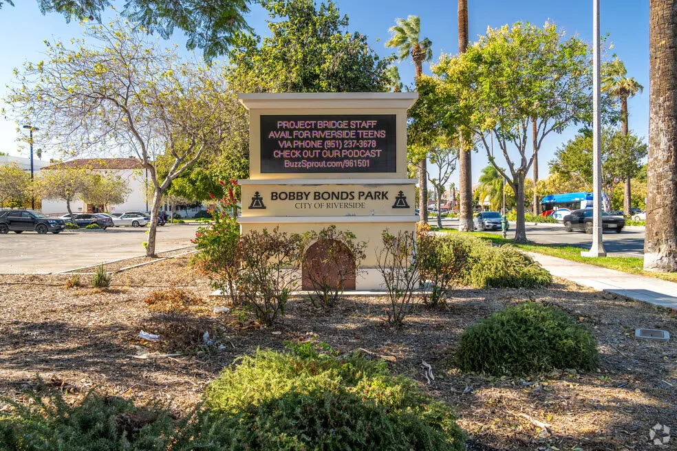
Bobby Bonds Park, Eastside Riverside
Fig. 03Bobby Bonds Park, an Eastside gathering place and the home of the Eastside Fall Festival. Photo credit pending.
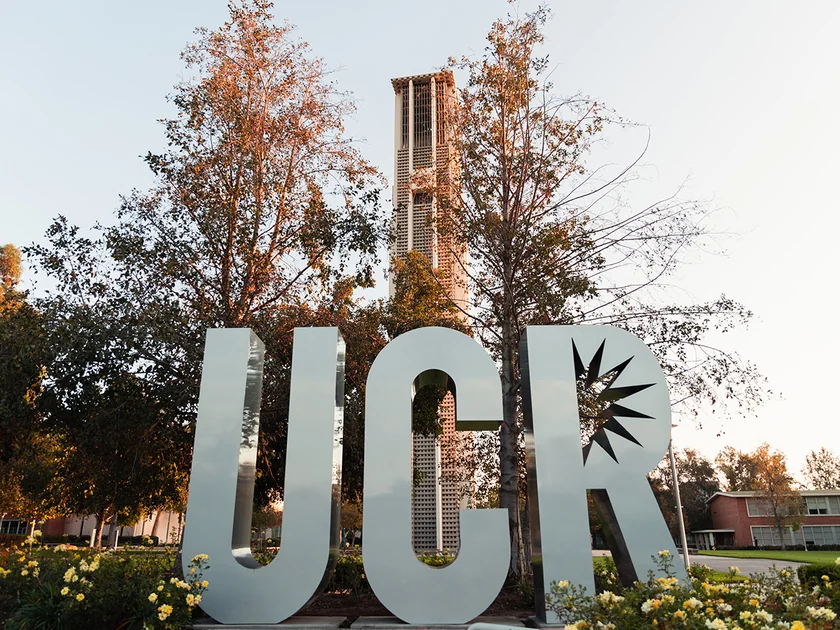
University of California, Riverside campus
Fig. 04UC Riverside, the corridor’s eastern anchor and the source of demand for student housing, food and services. Photo credit pending.
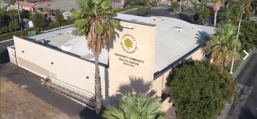
Community health center on the Eastside
Fig. 05Community services along the corridor: healthcare, education and government are among the area’s largest employers. Photo credit pending.

02Layers

Twelve ways to read one block.

Each diagram isolates one force acting on the site. Choose a layer and the sheet pans to it.
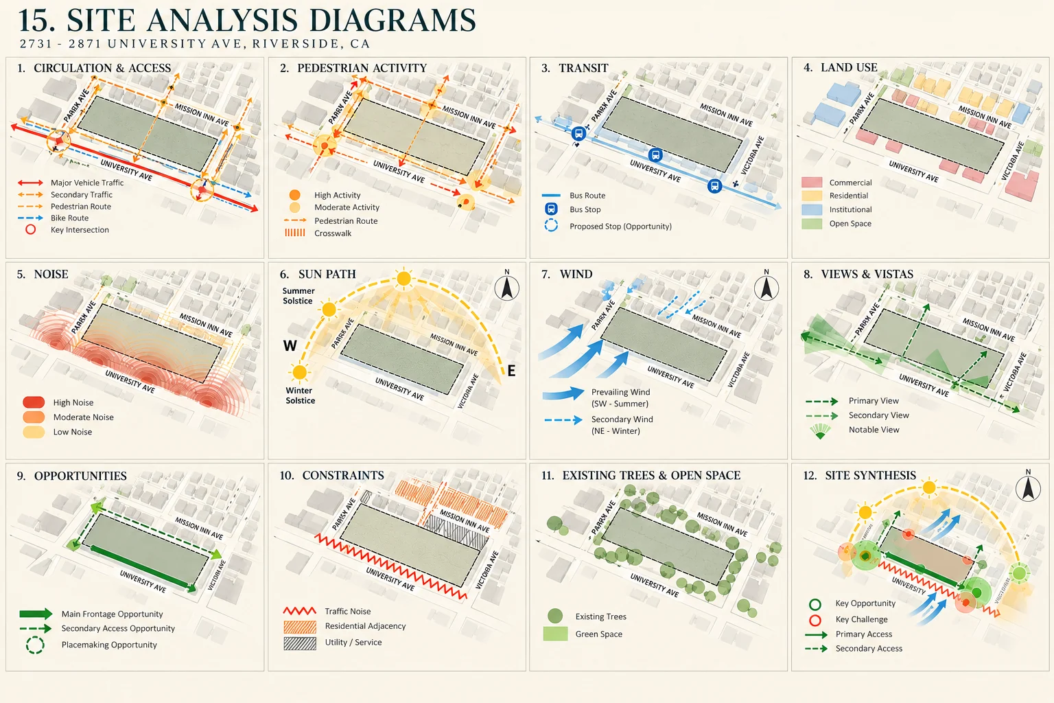
Fig. 06 · Panel 01 of 12

Circulation and access

View the full sheet
Sheet of twelve site analysis diagrams on the same base plan: circulation, pedestrian activity, transit, land use, noise, sun path, wind, views, opportunities, constraints, trees and open space, and synthesis

University Avenue carries the corridor’s through traffic, about 21,800 vehicles a day. Park Avenue and Victoria Avenue give secondary access; pedestrian routes run along the frontage.

03Time

Thirty-five years of plans.

The city has been planning for this block since 1991. The next chapter was approved this year.

1991

Zoning and streetscape changes along University Avenue set the corridor’s direction.

1993

The University Avenue Specific Plan is adopted, linking Downtown and the campus.

2006

The Redevelopment Agency buys the parcels, assembling the block.

2014–15

Redevelopment attempts and community input; no project proceeds.

2020–22

The land is declared surplus and mixed-use proposals are sought.

2026

Agreements for redevelopment are approved.

Fig. 07 · Then and now

The same block, two moments.

Drag across the image, or focus it and use the arrow keys.
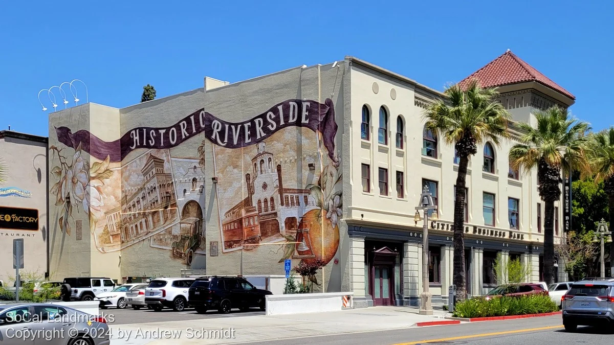
Current site plan of the blockHistoric Riverside mural, placeholder for a historic aerialThenNow

Fig. 07Placeholder pair. Left: historic Riverside mural, photograph © 2024 Andrew Schnell. Right: current site plan. Two matching top-down aerials (Google Earth Pro) replace these on Wednesday.

04Findings

What the site gives, and what it asks.

The analysis points one way: a block that opens to the avenue by day and shelters its residents from it by night.

Opportunities

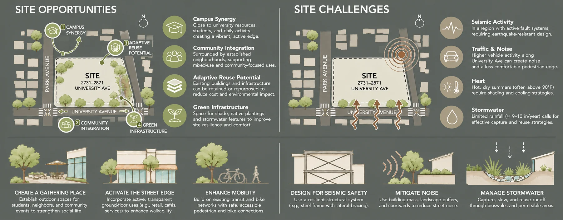
Create a gathering place. Activate the street edge. Enhance mobility.

Campus synergyStudent housing, study space and food a short ride from UC Riverside, Riverside City College and UEI College.
Community integrationA public corner and ground-floor program that serve the Eastside first.
Adaptive reuseKeep what carries the corridor’s mid-century character where it is sound.
Green infrastructureShade trees, bioswales and courtyards that cool the block and slow stormwater.
Transit at the doorRTA Route 1 stops on the frontage; the Metrolink station is a mile west.

Challenges

Mitigate noise. Manage stormwater. Design for seismic safety.

Traffic and noiseAbout 21,800 vehicles a day pass the south edge; pedestrian safety, parking and service access all compete for it.
HeatHot, dry summers and a low-rise context that casts almost no shade on the block.
StormwaterNine to ten inches of rain a year arrive in a few winter storms over mostly hard surfaces.
Seismic activityInland Southern California; structure and detailing must assume strong ground motion.
DisplacementNew investment on the Eastside has to avoid pushing out the households already here.

Sun over the site · live

Where the sun is above 2731 University Avenue right now, and how high it climbs today.

—

Calculating the sun’s position over the site…

TodayJune 21 and December 21, the highest and lowest the sun gets all year
Sunrise—
Highest today—
Sunset—
Daylight—

Why it matters: the long south frontage on University Avenue takes the sun all day. In June it stands almost straight overhead, so the street edge needs deep shade; in December it drops low enough to reach far into south-facing rooms.
University Avenue21,800vehicles a day near Jack B. Clarke Street
Rainfall9–10in a yeararriving in a few winter storms over mostly hard surfaces
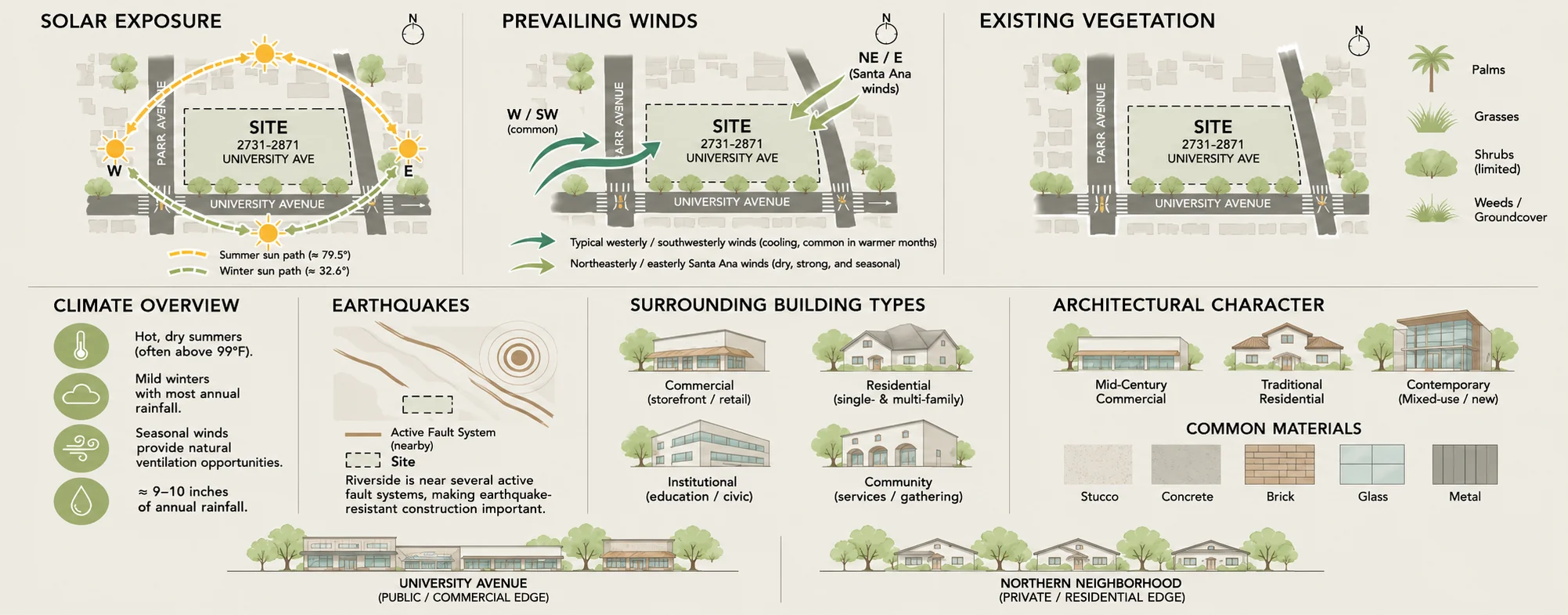
Climate and built environment board: solar exposure, prevailing winds, existing vegetation, climate overview, earthquakes, surrounding building types, architectural character and common materials
Fig. 08Climate and built environment: sun, wind, vegetation, seismicity, surrounding building types and materials. Drawn by QuiteCHIC Designs.
Site opportunities and challenges board with annotated site plans and six design responses
Fig. 09Opportunities and challenges, with six design responses: a gathering place, an active street edge, mobility, seismic safety, noise and stormwater. Drawn by QuiteCHIC Designs.

05Point of view Draft

Is the site advisable for the client? Our answer, and the conditions attached to it.

Build here: a walkable, community-first mixed-use project that shields itself from University Avenue’s noise and heat.

With conditions

Active ground floor and patio setbacks on the avenue; quiet, shaded program toward Mission Inn Avenue.

A public corner at Park Avenue that the neighborhood can use without buying anything.

Housing that includes the Eastside households already here, not only students.

Shade, stormwater and seismic strategy designed in from the first sketch, not added later.

The group settles the final wording and conditions on Wednesday.

The reportRead the full analysisEighteen sections, every figure, every source, with page numbers that match this site.The presentationWatch the studio presentationThe ten-minute version, as presented to the class.QuiteCHIC DesignsMeet the teamSix people, one firm identity across the report, the deck and this site.